San Antonio Storms End 33-Day Drought as 60 mph Winds Leave 50,000 Without Power

A 33-day stretch without measurable rain in San Antonio came to a sudden end on August 28, 2026, as severe thunderstorms pushed through the area with wind gusts near 60 mph and left about 50,000 customers without power.
The storms brought needed rain after more than a month of dry weather, but the relief came with damage, outages, and travel hazards. Strong winds knocked down tree limbs, strained power lines, and briefly turned parts of the city from hot and dry to storm-darkened and dangerous.
For many residents, the main impact was immediate: lights went out, air conditioners stopped running, and intersections became harder to navigate as crews began working through scattered outages.
Support for Affected Residents
With the generous help of donations, the US foundation was able to provide essential resources to the affected residents. This included:
Clean drinking water
Gift cards to assist with immediate needs
The support received has made a significant difference in the lives of those impacted, helping them to recover and rebuild during this challenging time.
Storms broke the dry spell and created a fast-moving emergency
The August 28 storms ended what had become a notable dry streak for San Antonio. For 33 days, the city had gone without measurable rainfall, a long enough stretch to dry out lawns, stress trees, and harden soil across the area.
When rain finally arrived, it came with severe weather rather than a gentle soaking.
The line of storms brought wind gusts around 60 mph, a level strong enough to cause damage even without a confirmed tornado. Thunderstorm winds at that speed can snap weakened branches, push patio furniture into yards, and bring down power lines when trees or limbs fall across them.
The quick change in conditions also raised the risk for drivers. Dry roads can become slick when rain first falls because oil, dust, and debris rise to the surface. Add sudden wind, lowered visibility, and standing water in low spots, and routine evening trips can become difficult fast.
The most important facts from the event were clear:
Key detail | What happened |
Date | August 28, 2026 |
Location | San Antonio area |
Dry streak | 33 days without measurable rain |
Peak storm threat | Wind gusts around 60 mph |
Power impact | About 50,000 customers lost electricity |
The storm system delivered two very different outcomes at once. It brought rain the region needed, and it produced enough wind to trigger widespread disruption.
Power outages became the main impact across the area
The largest immediate problem was the loss of electricity. About 50,000 customers were without power after the storms moved through, according to the reported outage total in the event brief.
Outages during severe thunderstorms often come from several causes at the same time. Tree limbs can fall onto lines. Wind can damage equipment. Lightning can affect parts of the grid. Crews then have to inspect, isolate hazards, and safely restore service, often while rain and wind are still moving through or while roads remain blocked.
For households, a power outage in late August carries extra weight in South Texas. Even after sunset, warm indoor temperatures can rise quickly when air conditioning shuts off. Refrigerators and freezers become a concern if an outage lasts for several hours. Medical equipment that depends on electricity can make the situation urgent for some residents.
Traffic can also slow when signals go dark. Drivers approaching an intersection with a nonworking signal should treat it as an all-way stop unless law enforcement or temporary traffic control directs otherwise.
The outage total did not mean every customer faced the same repair timeline. Some outages may have involved a single transformer or a small cluster of homes. Others may have required larger line repairs or tree removal before crews could safely restore power.
Why 60 mph thunderstorm winds matter
A 60 mph wind gust is more than a rough breeze. It is severe thunderstorm criteria and can produce damage similar to what people sometimes associate with weak tornadoes, especially when the wind runs through neighborhoods filled with mature trees, fences, sheds, and power lines.
Straight-line winds can spread damage over a broad area. They may push in one general direction, leaving branches, trash bins, and debris scattered along streets and yards. The damage can be uneven, with one block seeing snapped limbs while another nearby block has little more than heavy rain.
That uneven pattern can make storms feel unpredictable. A resident may see only a loud burst of wind and a flicker of lights, while someone a mile away may deal with a tree across a driveway.
Common hazards after 60 mph storm winds include:
Downed or sagging power lines
Broken tree limbs hanging overhead
Loose roofing material or damaged fences
Debris in roads and drainage areas
Malfunctioning traffic signals
Flooded low-water crossings
The most dangerous hazard is often the one that looks ordinary from a distance. A downed power line can blend into wet pavement, grass, or scattered branches. Anyone who sees a line on the ground should stay far away and report it to the utility or emergency dispatch.
People should also avoid walking or driving through standing water. Even shallow-looking water can hide debris, open utility covers, or a washed-out section of road.
Rain helped, but one storm does not erase every dry-weather risk
The end of the 33-day dry streak was meaningful, especially after weeks of heat and limited rainfall. Grass, trees, gardens, and dry soil all benefit when rain returns.
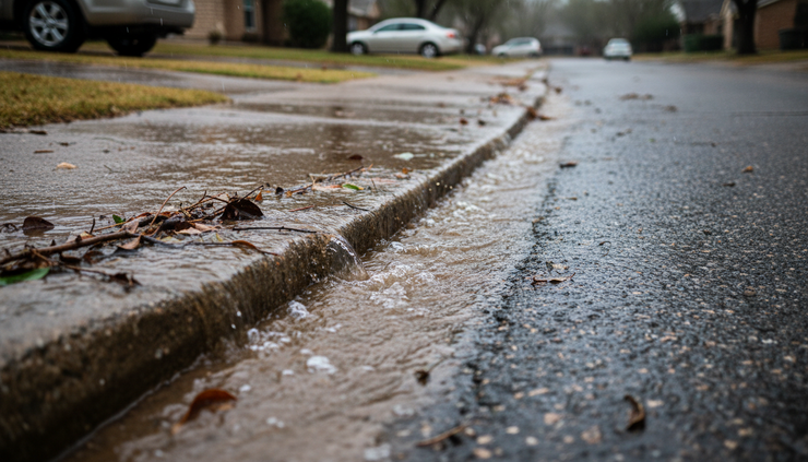
Still, a single storm does not always solve longer-term dryness. When soil becomes very dry, heavy rain can run off instead of soaking in evenly. That can lead to puddling, street runoff, and short bursts of minor flooding while deeper soil stays relatively dry.
This is why the storm was both welcome and disruptive. The rain broke the dry spell, but the fast delivery brought wind damage and outage problems instead of steady relief.
Dry weather can also leave trees stressed. Stressed trees may be more likely to lose limbs during high winds, especially if branches were already weak, dead, or poorly attached. That can increase the risk of damage when the first significant storm arrives after a long dry stretch.
For property owners, the days after a storm are a good time to look for visible signs of damage from the ground. That includes cracked limbs, leaning trees, loose gutters, missing shingles, or fencing that shifted in the wind. Climbing onto roofs or trimming large storm-damaged limbs near power lines should be left to trained professionals.
Safety concerns continued after the storms moved out
The danger from severe weather does not end when thunder fades. After a storm with 60 mph winds, cleanup can expose people to electrical hazards, unstable trees, sharp debris, and carbon monoxide risks from improper generator use.
Residents cleaning up after the August 28 storms faced several practical concerns.
Downed lines should be treated as live. No one should touch a wire or anything in contact with it, including fences, branches, or vehicles. Wet ground can increase the risk.
Generators must stay outside. Portable generators should never run inside a home, garage, porch, or enclosed area. They produce carbon monoxide, an odorless gas that can be deadly.
Food safety matters during longer outages. A refrigerator can keep food cold for a limited time if the door stays closed. Freezers hold temperature longer when full and unopened. When in doubt, people should follow food safety guidance from public health agencies rather than relying on smell or appearance.
Tree cleanup requires caution. Branches under tension can shift suddenly when cut. Large limbs, leaning trunks, and branches tangled in lines are not safe for do-it-yourself removal.
Stormwater can carry hazards. Flooded streets and drainage channels may contain sharp objects, sewage, chemicals, or hidden holes.
The same storm that ends a dry streak can create a long tail of cleanup. That work is slower when outages are widespread and crews must handle the most dangerous problems first.
What residents can expect during restoration
After a large outage event, utility restoration usually follows a priority order. Crews first focus on hazards that threaten public safety, such as live wires on roads or near homes. They also work to restore power to critical services where needed.
Next, crews often repair larger equipment or main lines that can bring power back to the greatest number of customers. Smaller neighborhood outages and individual service problems may take longer because they require more targeted repairs.
That process can frustrate customers who see power return nearby while their home remains dark. It often means the outage serving one location has a different cause than the outage serving the next street.
Residents can make restoration work safer by keeping a clear distance from repair crews, reporting damage through official utility channels, and avoiding the urge to move branches near wires.
Useful steps during an outage include:
Turn off or unplug sensitive electronics to reduce the risk from power surges.
Keep refrigerator and freezer doors closed as much as possible.
Use flashlights instead of candles when possible.
Check on neighbors who may need help, especially older adults or people who rely on powered medical devices.
Do not run a vehicle inside a garage to charge devices, even with the garage door open.
Power restoration after severe weather is not just a technical job. It is also a safety operation, especially when crews are working around wet roads, damaged trees, and energized equipment.
The storm fits a familiar South Texas pattern
Late-summer storms in South Texas can be intense because the atmosphere often holds deep moisture and heat. When storms develop or move into that environment, they can produce heavy rain, frequent lightning, and damaging wind in a short period.
San Antonio’s August 28 storm was notable because it arrived after a 33-day dry stretch. That made the rain more noticeable, but it also meant the first significant storm had to interact with dry ground, stressed vegetation, and residents who had gone weeks without wet roads.
This kind of pattern is one reason forecasters and emergency managers emphasize preparedness even during dry weather. A quiet stretch does not remove storm risk. It can make the first storm feel more abrupt.
A basic severe weather kit does not need to be complicated. It can include:
Flashlights and extra batteries
A charged power bank
Drinking water
Shelf-stable food
A battery-powered or hand-crank radio
Basic first aid supplies
Copies of key information stored offline
A plan for pets, medications, and mobility needs
Preparedness makes the biggest difference when it is done before the sky darkens. Once winds rise and power fails, even simple tasks become harder.
What comes next for San Antonio
The immediate focus after the August 28 storms was restoration and cleanup. With about 50,000 customers affected, crews had to assess damage, clear hazards, and bring service back safely.
The rain also reset the city’s dry streak, ending 33 days without measurable rainfall. That does not mean the area is free from future weather concerns. More storms can follow in late summer, and heat can return quickly after rain moves out.
For residents, the best next step is practical caution. Avoid damaged areas, stay clear of downed wires, document property damage from a safe distance, and use official sources for outage and weather updates.
The August 28 storms brought San Antonio the rain it had been waiting for, but they also showed how quickly drought relief can turn into a severe weather emergency. The lesson is simple: welcome the rain, respect the wind, and stay ready for both.


Comments